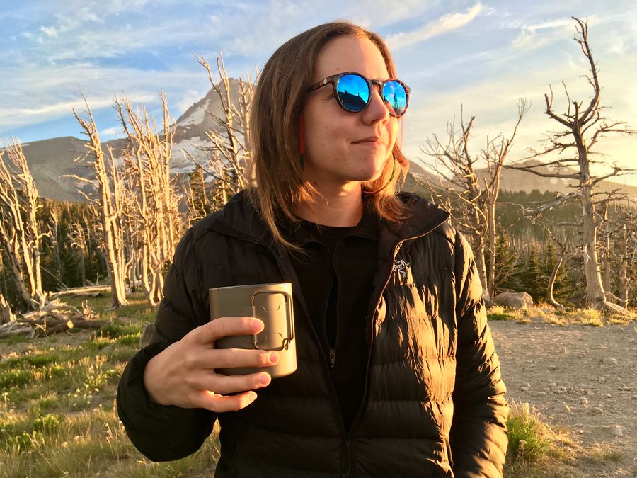
Last week I completed the Timberline Trail, a roughly 40-mile loop that circumnavigates Mt. Hood in Oregon. I also turned 37. I feel like this is a pretty good note to begin a new year on.
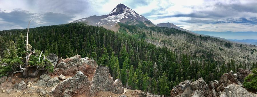
Our party (Laurel, myself, and two friends from CA) opted to do the hike over 5 days / 4 nights instead of the traditional 4 days / 3 nights. We all had the full week off so why rush, was the thinking. But even with an extra day to complete the loop, the hike was still quite a challenge. Especially on the second day, where we had to navigate a massive blow-down area in the forest (even after taking a detour to avoid a part of the trail that recently became impassable). Still, hiking the trail was a great experience and I highly recommend it; there is something really great about disconnecting from the modern world for a few days and being fully engaged with nature.
A map of our full route can be found on AllTrails.
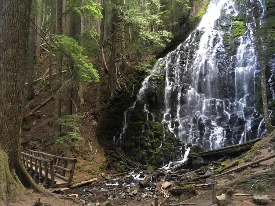
Day 1: Timberline Lodge to Ramona Falls
I hadn’t done as much pre-hike training as I probably should have in the weeks leading up to the trip, so this was a “train on the trail” kind of a day. Fortunately it was mostly downhill! We opted to hike the trail in the traditional clockwise direction, so for the first day we went North from the Timberline lodge until we hit Ramona Falls, about 10 miles.
This was the busiest part of the trail. A lot of families with kids, trail-runners, and day-hikers go out to places like Paradise Cove (about 5 miles from the Lodge) and then go back. Seems like a nice one or two day trip.
We forded the Sandy River and continued on to Ramona Falls, a highlight of the trail. The falls are spectacular and there is a nice campground right next to them, so we spent the first night here. The area near the falls was somewhat buggy, and we benefitted from Laurel’s “thermocell” bug deterrent device.
Day 2: Ramona Falls to Elk Cove
The hardest day, without a doubt. Lots of climbing, and we were harried by biting horseflies for much of the day. This was also the area of the trail that had suffered the most damage from the terrible windstorm of Labor Day weekend 2020 (the same storm which led to terrible smoke and fires in much of Oregon). A segment of the Timberline Trail was actually impassable here due to tree-fall, so we took a detour that involved following the Pacific Crest Trail for a short distance before re-connecting. But even with the detour, the route we took was full of fallen trees that had to be scrambled over. These conditions plus several miles of relatively steep climbing (and biting flies) made this day a real slog. We got some great views at a few points though!
After a long day of hiking we were happy to reach the Elk Cove campground. However, the trail was still pretty crowded that day and all of the campsites were taken. Fortunately we ran into a fellow hiker as we refilled our water in a nearby stream; she was doing the trail alone with her dog and invited us to join her at a spot she found on the other side of a small meadow. This experience was a good example of the camaraderie we saw among backpackers throughout the trek, everyone we encountered was friendly and helpful.
Day 3: Elk Cove to Cloud Cap
We had a clear sky and a nice morning in our camp by the meadow. Despite being exhausted from the previous day’s hike, we wanted to get an early start this day to deal with what we’d heard were the two most serious river crossings of the trail: the Coe and the Elliott.
The rivers on the slopes of Mount Hood are fed by glaciers and snowmelt. More snow melted as the days progressed, which made crossing more difficult (faster current and higher water level). Our goal was to do these difficult crossings as early in the day as possible while the water was at its lowest point.
The Coe River was very close to our camp and we were able to hit it first thing in the morning; crossing was pretty straightforward. We reached the Elliott around 1pm, after several hours of hiking up and down a series of ridges on the north side of the mountain.
The water was high and the current was clearly very strong here, so we took some time to survey the landscape before crossing. Just getting down to the water was a challenge – the river sat at the bottom of a deep “V” of sandy and loose terrain. Once there, we looked for cairns – little piles of rocks left by previous hikers to indicate a good crossing point. Unfortunately we didn’t see any good way to “rock hop”, so we rolled up our pants and switched out our boots for sandals. It looked like we were going to have to wade in.
Laurel and I spent a few more minutes looking for a shallow area to ford. Finally, I just went for it – wading in at an area that seemed promising. The knee-deep water was freezing! The cold almost burned, and the current was strong enough to make walking a challenge. But with a few steps I was able to reach the other side, and Laurel was able to use the same route without issues.
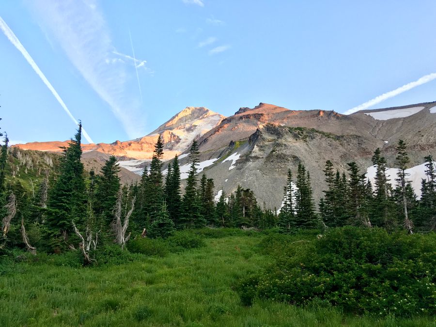
Now that we had crossed the fearsome river, we could finally relax. A short steep climb back out of the ravine took us up to Cloud Cap, a drive-in campsite that was also the location of the historic Cloud Cap Inn. Built in 1889, the Inn is sort of the predecessor to the Timberline Lodge. It was a luxury mountaineering retreat that featured amenities like telephones for the guests. The structure is closed now but still gets used occasionally for events, or as the staging ground for rescue efforts on the mountain. We caught a great sunset up on the grounds of the Inn later that evening, with some fellow campers at the site.
Cloud Cap campground had some “luxuries” of its own – a pit toilet and a spigot of potable water. We took the opportunity to wash some clothes and relax after two long days.
Day 4: Cloud Cap to Mitchell Creek
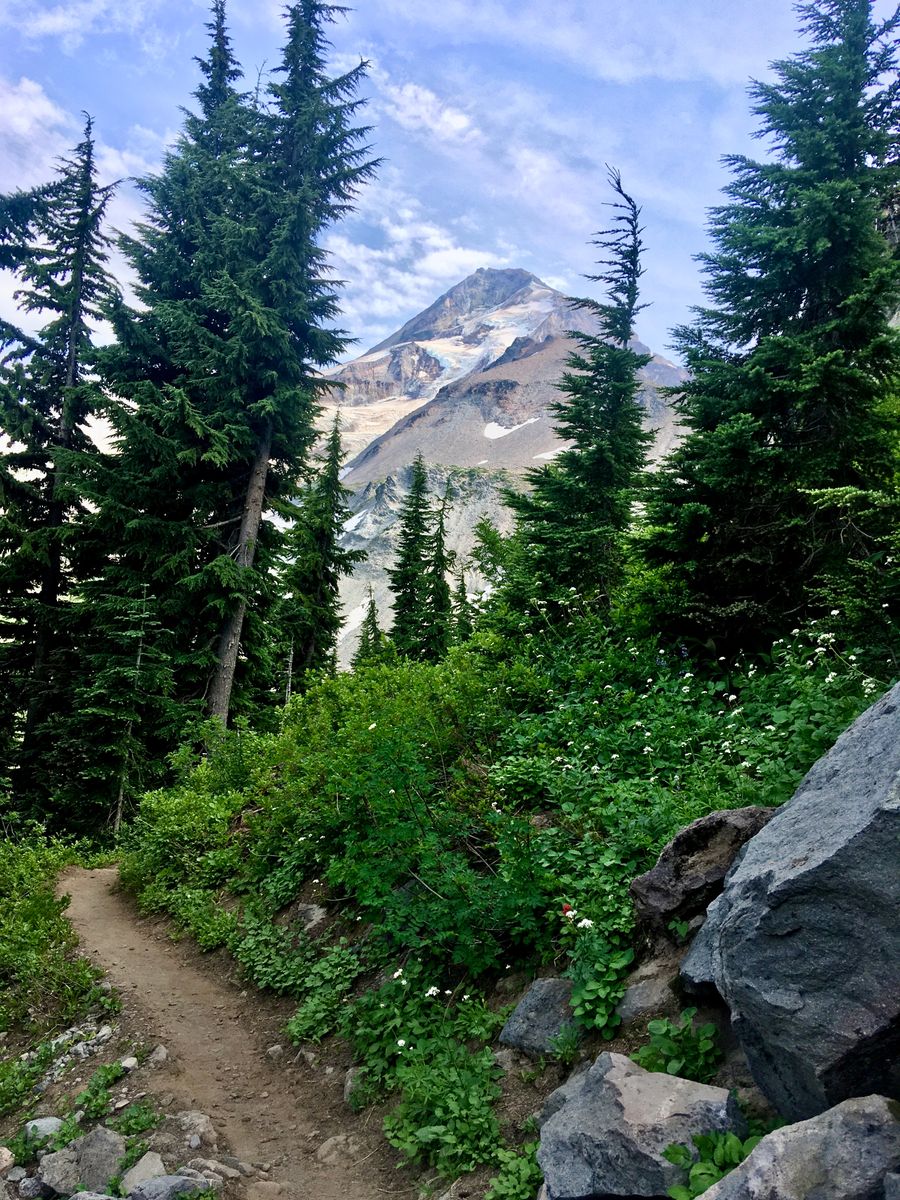
After our rest day at Cloud Cap, we were ready for our last long day of the trip. The route here climbed up from Cloud Cap (6000’) up to 7300’ over about 2 miles. This put us above the treeline, giving us spectacular views of the mountain and the surrounding region to the North and East.
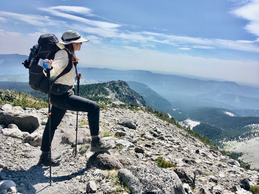
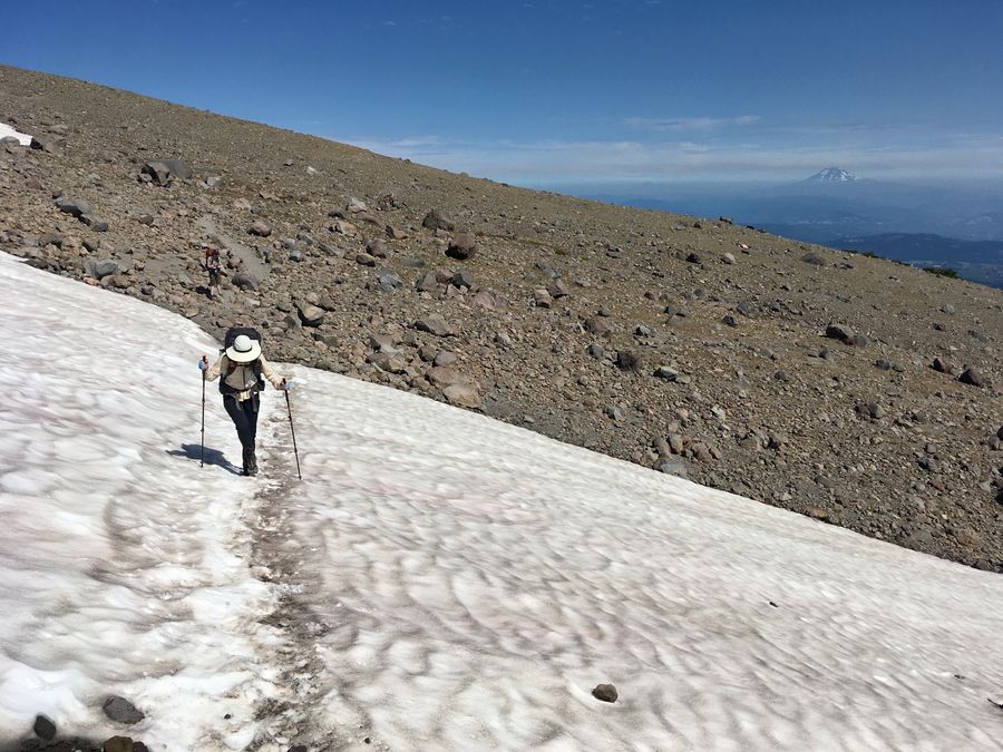
This part of the hike was my favorite. After the initial climb we stayed up on the high ridges for most of the day, so it wasn’t as taxing as Day 2 had been. This stretch also transitioned through several different ecosystems. We emerged from the lush, rainy, temperate rainforest western side of the mountain to the drier eastern side. In the distance we could see Oregon’s eastern deserts instead of the forest and farmland we saw previously. Lower elevations of this section were covered in tough plants like juniper bushes, while hiking through the higher sections felt like walking on the surface of the moon. We even crossed a few patches of snow, and we could look up and see the blue-green glacial ice on the Northeast face of the mountain. This stretch of the hike yielded many spectacular views.
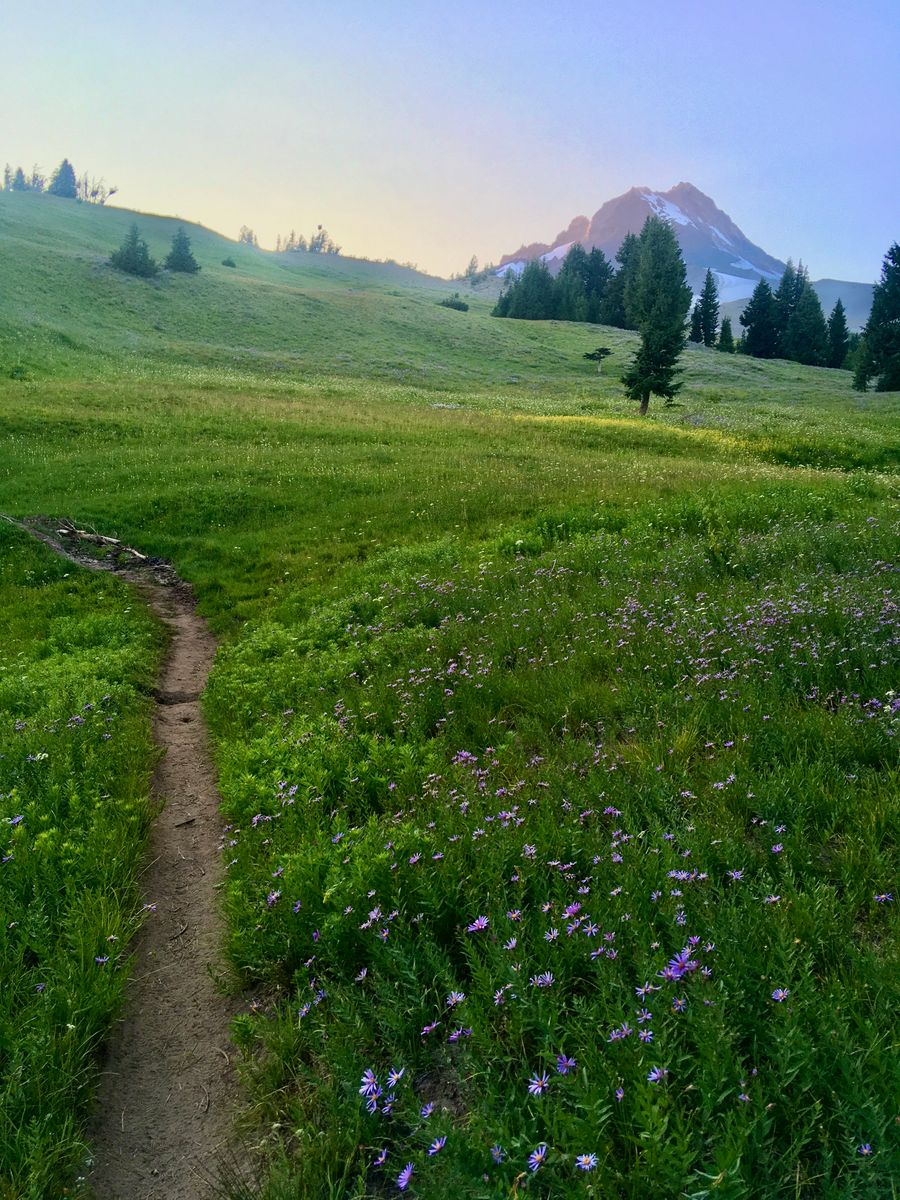
After several hours at elevation we descended back down below the treeline and crossed a few small streams. Nelson Creek was the most significant out of these, but the afternoon crossing wasn’t too challenging. As we got to the southern slopes of Hood the environment became lush again, but now the forest gave way to meadows full of wildflowers. It was like a scene from The Sound of Music. Mount Hood Meadows is a popular ski resort in the winter, and we hiked through an area of ski lifts.
After crossing Mitchel Creek (roughly 10 miles from where we started), we decided to camp by a grove of trees next to one of these meadows. We could have pushed on to the lodge at this point but we didn’t want to have to drive back into Portland late at night.
Day 5: Mitchell Creek to Timberline Lodge
We thought our final day would be a cakewalk, but it turned out being more of a challenge than we expected. After fording our last major river (the White River), we were faced with a long slow climb back up to the lodge. This stretch was largely made up of soft sand, and was very exposed in the heat. It was a lot of work!
We were so happy to finally make it back to the parking lot and our waiting van. After changing out of our hiking clothes, we went straight for the breakfast buffet at Timberline Lodge – we felt like royalty stuffing our faces.
Another group of backpackers was leaving as we arrived, so we struck up a conversation with them. They were on mile 2100 of a hike that started in Mexico and were planning to continue all the way to Canada! Our little 40-mile trip was nothing compared to this kind of continent-spanning trek; it's a reminder to be humble I guess. Even so, walking all the way around one of the major landmarks of the Portland area feels like a significant achievement, and I'm glad I went. Maybe next time we'll do the trek in 4 days and avoid bringing way too much food.